
We left for the hike around 1 p.m. We just followed the signs as best as we could. At one point we thought we needed to go straight and that wasn't correct. So, we found ourselves on a narrow dirt road that dead ended and no where to turn around. The narrow road had a dropoff on the passsengers side, so I was nervous as Zack backed up the road. It took us about 10 minutes, but once again Zack was able to manuever the car and get us out of a sticky situation.
We were on our way again and finally headed up the right direction. As we were driving we saw several cars parked along the road. We weren't sure if we could continue to go up further or if we should just park the car. So, we decided to park the car and walk. We walked for awhile and cars were passing us on the road and we realized that we could have driven a little further. While walking up the road to the waterfall, we saw all this shale rock. Zack told me that this is the rock that arrowheads are made from. We weren't able to find any arrowheads today, too bad.

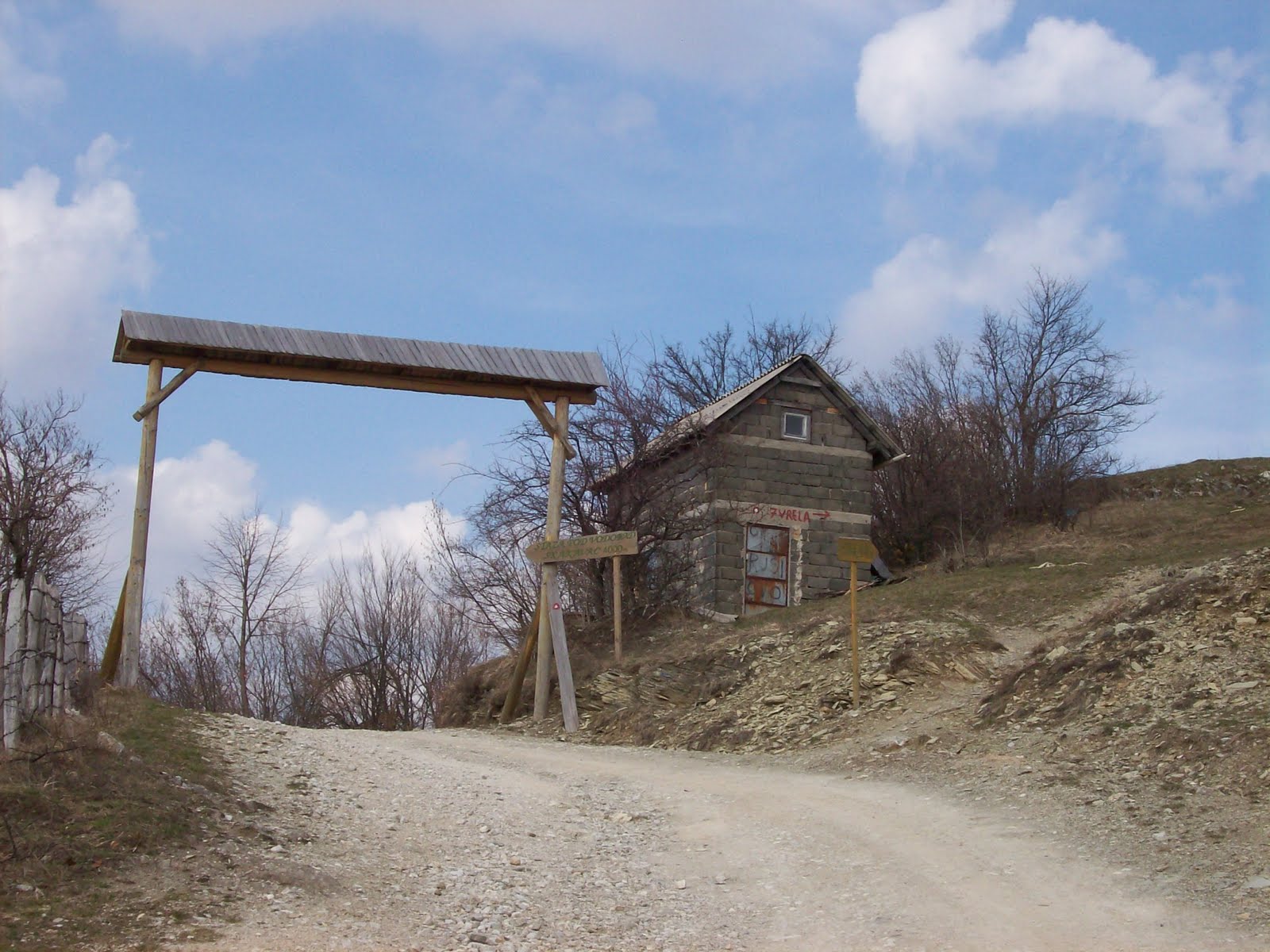
As we continued walking, we came across this house with a map in front of it. Of course, we couldn't tell from the map where we were, but we took some pictures and kept walking. At this point there were some other people walking in front of us as well.

 |
Still walking |
We finally made it to a sign that pointed us in the direcction of the trees and said that the waterfall was another 4000m through the woods. Before we got to this sign there was another area where cars parked, so we could have driven nearly to the waterfall if only we knew. So we hiked off the road and started walking through the forest. Luckily there were markers in the forest to tell us the way to go.

We walked for a little while stopping to take more pictures along the way.

 |
| A stump catching the rain water. |

 |
| Trail marker |
The walk became a little easier since it was all downhill after a certain point. Then I started to think that we would have to climb back up to get out of here, but we were going to see a waterfall, so I could think about that later.
 |
| Stairs going down to the bottom |
We finally made it the bottom of the waterfall. We were a little disappointed by the size of the waterfall. It wasn't what we were expecting, but it was a great day for a hike.

After staying at the bottom for about 10 minutes, we finally started to walk back to the car. It took us all together about four in a half hours to complete our hike to the waterfall and back to our car. If we were to hike to the waterfall again I think we would drive up as far as we could and hike from that point cutting out 3 hours or so from our hike.
No comments:
Post a Comment